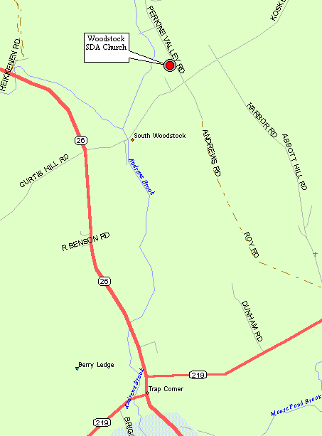
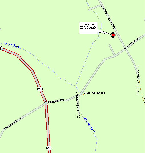
Directions From The South (Portland, ME)
Go north on I-95/495. Take EXIT 11. Take a right at the stop
light (US-202). Take a left at the 2nd stop light. Take another left
at the 3rd stop light onto Route 26 North. You will continue on rt.
26 for nearly 37 miles through the towns of Poland, Oxford, Norway, South &
West Paris etc. Turn Right onto Andrews Road. Take your first
left onto Perkins Valley Road. The church is immediately on your
left. Use the maps below for a better picture. Total mileage is
about 55 miles from Portland and it will take about 1 hour 40 minutes.
Directions From The North (Bethel, ME)
Go south on Route 26 for about 13 miles through the towns of Locke Mills
and Bryant Pond. Turn left onto Andrews Road. Take
your first left onto Perkins Valley Road. The church is immediately
on your left. Use the maps below for a better picture. Total mileage
is about 14 miles from Bethel and it will take about 30 minutes.
You are visitor #
Last Updated 03/02/02 12:05 AM
Return To The Previous
Page
Return To The Woodstock SDA Homepage
Search The Woodstock SDA Website
Email The Website Administrator